Fragile Landscapes and US Bureau of Land Management Solutions
As a photographer, I am interested in unusual landscapes and recently visited the Vermillion Cliffs National Monument, a 280,000-acre property administered by The Bureau of Land Management (BLM). One hot spot for photographers is “The Wave”, a mesmerizing set of sandstone formations in northern Arizona eroded by water and wind.
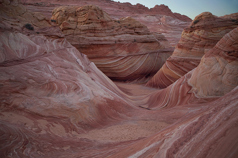
The Wave at Coyote Buttes North, Arizona
The expansion of the Internet has publicized The Wave – specifically thorough the proliferation of images and video available on the web. In addition, an article on the Vermillion Cliffs in the February 2012 issue of the National Geographic Magazine sparked the interest in The Wave and other nearby formations for millions of their readers.
Given this publicity, the challenge is how to keep too many visitors from spoiling the place.
The BLM is a federal agency that is responsible for the stewardship of 245 million acres of public land in the United States. The agency employs 10,000 individuals full time, but doing the math, this is about 2,500 acres of land per employee. And like the US Forest Service, a great percentage of BLM land is designated “multipurpose”.
The tag line for the Forest Service is “Land of Many Uses”, which has been tweaked by environmentalists to “Land of Many Abuses”. In many of their operations, the BLM is a contender for this title.
However, in June of 2000, The National Landscape Conservation System was set up. It consists of 27 million acres of the most pristine landscapes and ecosystems that are under the purveyance of the BLM, including the Vermillion Cliffs. These areas are primarily in the Western and Southwestern US. After the formation of these Conservation Lands, the BLM incorporated many of the tenants of responsible tourism with their administration of these remarkable resources.
Several methods are used to minimize wear and tear from tourists traveling to sensitive/fragile areas.
• Education (stay on trails, don’t litter, etc.)
• High fees (high entry fees limit people to those who can afford to go)
• Limit official access (establish restricted areas where permits are needed)
• Limit publicity (difficult for potential visitors to discover location)
• Difficult terrain (hard location to get to, need to hike in or have special vehicle)
In view of this list of ways to mitigate visitor traffic, how could the BLM respond to the high demand for visits to The Wave? Not by regulating publicity (out of their control) or high fees. The monument is a national treasure, and as such the government is reluctant to charge high fees to visit it. $7.00 is the cost for a one-day permit.
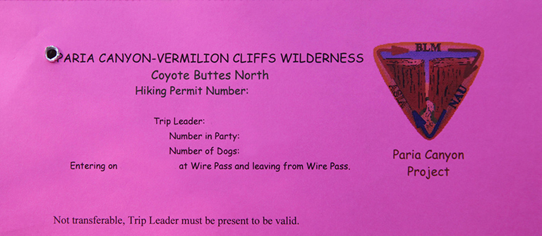
Required pack tag to be in restricted area
So, to their credit, the BLM limits the number of visitors to The Wave to 20 per day and has instituted a lottery – ten from their website and ten from applicants that arrive in person for the next day’s allotment. If you are interested in the details for applying you can go here.
Competition is fierce. For instance, the number of online applicants for April 19, 2014 is 257 and the maximum number of people allowed is six per applicant. So far 975 people are listed who want to go (an applicant can have from one to six people in their application – 10 total will go). For reference, individuals attempting to obtain a permit for April-June and September-November, the odds were about 4-5% for 2013. The $5.00 application fee is non-refundable.
Another of the responsible-tourism tenants is education, and part of the Vermillion Cliffs application is a professionally-done17 minute video that deals with safety, trails, protection of the environment, etc. You cannot continue the application without checking a box that confirms you watched the video.
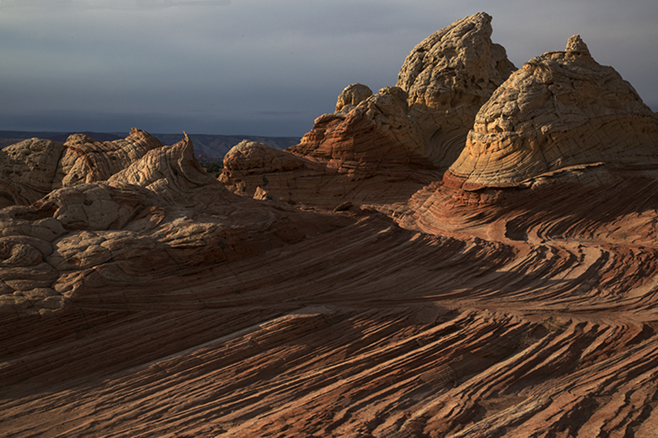
Sunset at White Pocket, Vermillion Cliffs, Arizona
Lastly, the difficulty of the terrain plays a part here. The Wave is a three-mile hike from the road with a large portion of it marked only by cairns. At the southern end of the Vermillion Cliffs Monument, the roads are sand, and every time a vehicle gets stuck (hundreds of times) that area becomes a sand pit. You can’t believe what the advertisements say about your four-wheeled drive vehicle – many of them won’t make this trip.
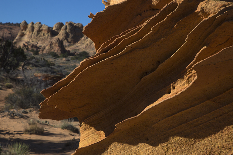
Fragile Rock Fins
Once you have won the lottery and are at these locations, you’ll see how fragile these formations are. Most have Navaho sandstone rock “fins” which are easy to snap off. Hundreds of years in the making – gone in a second.
The BLM will receive a $6 million increase from the federal government for the National Landscape Conservation System in 2014. If the BLM continues policies that promote responsible tourism, this is good news.