Who Are You, Brave Photojournalist?

Recently I attended the annual National Geographic Photography Seminar held at the Washington DC headquarters of NGS. It was great to see photographers and friends such as Nick Nichols, Steve McCurry, Jodi Cobb, George Steinmetz, et. al. Once a year is hardly enough to convene. As one National Geographic photographer said, “How come they always send me out there? What’s wrong with right here?” In short, we are gone a lot and fortunate that something like the seminar brings us together to commune in Photojournalism, where it is spelled with a capital “P”.

Several moving tributes to Robert E. Gilka, former Director of Photography who died in 2012 were given, both in on-screen form and by NGM executives. I always use a quote from a letter he wrote to a prospective photographer as a way to describe his view of the profession:

What I miss most in your pictures is the input of the photographer. You see what most of us see and that is not enough. To rise above the great pack of people calling themselves photographers, one must develop seeing senses to the utmost. It is with a special kind of seeing ability that photographers make interesting, exciting or provocative images.…My words are not likely to be comforting; they’re not meant to be. Photography is a tough profession.”

On the program this year was Tyler Hicks a New York Times photojournalist. He is what we sometimes refer to as a “bullet chaser” – in essence a war photographer. In 2013, 70 journalists were killed – over half were videographers or photographers. We are no longer considered “neutral” in combat, now it depends on which side you align with as to the degree of danger. Tyler has worked in Syria, Libya, Afghanistan, Pakistan, Iraq, Bosnia, Lebanon, Israel, Gaza and Chechnya  — usually countries where conflict is happening.

Tyler spoke and showed images of his work that in many cases was not done as an embedded (read controlled) journalist, but while operating on his wits, experience and, as he would agree, luck.

But none of his war images were as arresting as the images that he took at the Westgate Mall massacre in Nairobi, Kenya on September 21. 2013. I think that there are two reasons for this:

1. The mall is not a war zone, but a civilized shopping area that was overtaken by a group of terrorists who were very cavalier as they committed random carnage.

2. Tyler took several pictures from outside the complex, showing people fleeing the mall, wounded civilians, and bodies in cars where they had been gunned down in the parking lot. Tyler and his wife (also a journalist) then ENTERED the mall when the terrorists still controlled the area.

This left me thinking. If I were there would I, as a photojournalist, go into a place where I could plainly see by those fleeing that it was dangerous if not deadly? Obviously Tyler’s years as a war correspondent helped him understand some of the risks. As he said, when the good guys arrived, they did a store to store search, much like a house to house search in a war zone.

When in the field and in a dicey situation, we make decisions based on a recognition of risks, but sometimes we are wrong. An infamous National Geographic photographer was in Tiananmen Square, China during the repression of demonstrators on June 3 and 4, 1989. Not only did he not come back with pictures, but also he called the magazine and said he wanted the company to get him home as soon as possible to be back with his family.

So who are you, brave photojournalist? We would like to think that we are akin to Tyler, but until you are in the situation, you just don’t know. What I can say is that I am happy to be in a profession that has people like Tyler and Jim Nachtwey as members so that we can all see the unvarnished reality of life in their images.

An addendum to this post April 4, 2014: Heavy hearts as another photojournalist, Anja Niedringhaus, was murdered by an Afghan “policeman”. Many tributes to her on the web, but to see the power of her images, go to her site
Backup, Backup, Backup

Two days ago I did the unthinkable — I washed my cell phone. It was in an “Otter Box”, but soapy water still got into the phone.

As the phone was under a contract, I immediately looked on the net to see if I could revive it. Methods ran from using a vacuum to pull all of the water out to submerging it in a bag of rice, etc. Tried them all out, because in today’s world, a smart phone makes for mobile computing.

In short, yesterday I had to replace the phone. It had almost 12 GB of information on it, but I had little worries, as I knew that I had backed up the phone on my computer within the past few days. Sure enough, when I plugged it into my computer, all came back except for a few voicemails from last week and several text messages. No images were lost. If the text message were important, I could have asked the individuals who sent or received them to send them back to me, but they were not of that nature. And I’m sure that if I really needed any lost information that I could appeal to the NSA since they have all of it! Replacement of the phone was “free”.

Last year I had my camera pick-pocketed. In it was a 32 GB flash card. Every night in the field I download the day’s images onto an external “photo” hard drive that is made specifically for backups of CF and SD flash cards with slots for the cards and a screen for viewing stored images. So I lost about 20 pictures I had taken the morning before the theft — none prize winners. Insurance paid for the camera (and a model upgrade!).

A few years back, the hard drive on my computer went down, along with about 400 GB of applications, documents, and everything else that one “stores” on a computer. I had the hard drive replaced. Since I have automatic backup of everything on my computer (and my external hard drives consisting of 5 TB) I simply plugged the computer with the new hard drive into my backup drive and retrieved everything. Adobe and several other software manufacturers required me to re-enter my registration numbers, so keep those handy. The manufacturer later sent an email noting that the problem with the hard drive was theirs, and they eventually sent me a check for the amount of the replaced drive.

The point of this blog is to make sure you back up every device, and often. Fortunately, at this point in time, it is not hard to do. But do you do it? There is a saying about the computing world, “It is not if your device will go down, but when”. My son-in-law is a Marine and he says that for the Marines three is redundant.

Make it a point today to re-think where you stuff resides and if you have it backed up.

Fragile Landscapes and US Bureau of Land Management Solutions

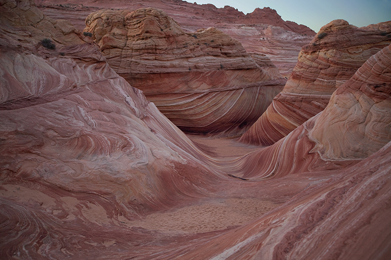
As a photographer, I am interested in unusual landscapes and recently visited the Vermillion Cliffs National Monument, a 280,000-acre property administered by The Bureau of Land Management (BLM). One hot spot for photographers is “The Wave”, a mesmerizing set of sandstone formations in northern Arizona eroded by water and wind.

The Wave

The Wave at Coyote Buttes North, Arizona

The expansion of the Internet has publicized The Wave – specifically thorough the proliferation of images and video available on the web. In addition, an article on the Vermillion Cliffs in the February 2012 issue of the National Geographic Magazine sparked the interest in The Wave and other nearby formations for millions of their readers.

Given this publicity, the challenge is how to keep too many visitors from spoiling the place.


The BLM is a federal agency that is responsible for the stewardship of 245 million acres of public land in the United States. The agency employs 10,000 individuals full time, but doing the math, this is about 2,500 acres of land per employee. And like the US Forest Service, a great percentage of BLM land is designated “multipurpose”.

The tag line for the Forest Service is “Land of Many Uses”, which has been tweaked by environmentalists to “Land of Many Abuses”. In many of their operations, the BLM is a contender for this title.

However, in June of 2000, The National Landscape Conservation System was set up. It consists of 27 million acres of the most pristine landscapes and ecosystems that are under the purveyance of the BLM, including the Vermillion Cliffs. These areas are primarily in the Western and Southwestern US. After the formation of these Conservation Lands, the BLM incorporated many of the tenants of responsible tourism with their administration of these remarkable resources.

Several methods are used to minimize wear and tear from tourists traveling to sensitive/fragile areas.

• Education (stay on trails, don’t litter, etc.)

• High fees (high entry fees limit people to those who can afford to go)

• Limit official access (establish restricted areas where permits are needed)

• Limit publicity (difficult for potential visitors to discover location)

• Difficult terrain (hard location to get to, need to hike in or have special vehicle)

In view of this list of ways to mitigate visitor traffic, how could the BLM respond to the high demand for visits to The Wave? Not by regulating publicity (out of their control) or high fees. The monument is a national treasure, and as such the government is reluctant to charge high fees to visit it. $7.00 is the cost for a one-day permit.

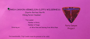
Permit

Required pack tag to be in restricted area

So, to their credit, the BLM limits the number of visitors to The Wave to 20 per day and has instituted a lottery – ten from their website and ten from applicants that arrive in person for the next day’s allotment. If you are interested in the details for applying you can go here.

Competition is fierce. For instance, the number of online applicants for April 19, 2014 is 257 and the maximum number of people allowed is six per applicant. So far 975 people are listed who want to go (an applicant can have from one to six people in their application – 10 total will go). For reference, individuals attempting to obtain a permit for April-June and September-November, the odds were about 4-5% for 2013. The $5.00 application fee is non-refundable.

Another of the responsible-tourism tenants is education, and part of the Vermillion Cliffs application is a professionally-done17 minute video that deals with safety, trails, protection of the environment, etc. You cannot continue the application without checking a box that confirms you watched the video.

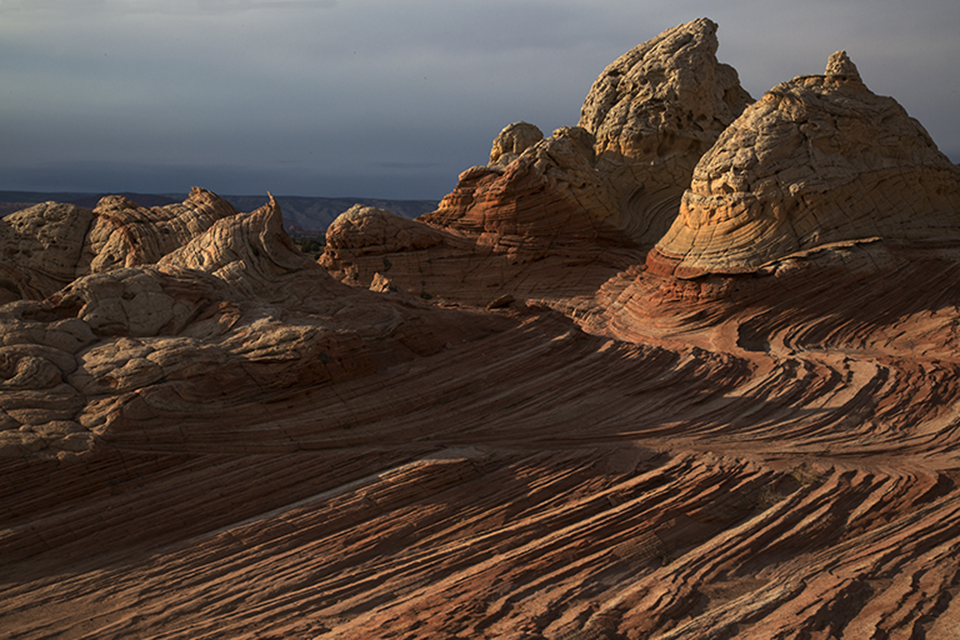
Two Peaks at Sunset 9344

Sunset at White Pocket, Vermillion Cliffs, Arizona

Lastly, the difficulty of the terrain plays a part here. The Wave is a three-mile hike from the road with a large portion of it marked only by cairns. At the southern end of the Vermillion Cliffs Monument, the roads are sand, and every time a vehicle gets stuck (hundreds of times) that area becomes a sand pit. You can’t believe what the advertisements say about your four-wheeled drive vehicle – many of them won’t make this trip.

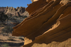
Rock fins

Fragile Rock Fins

Once you have won the lottery and are at these locations, you’ll see how fragile these formations are. Most have Navaho sandstone rock “fins” which are easy to snap off. Hundreds of years in the making – gone in a second.

The BLM will receive a $6 million increase from the federal government for the National Landscape Conservation System in 2014. If the BLM continues policies that promote responsible tourism, this is good news.